3.6km
Distance
—
Gain
—
Time
About this Trail
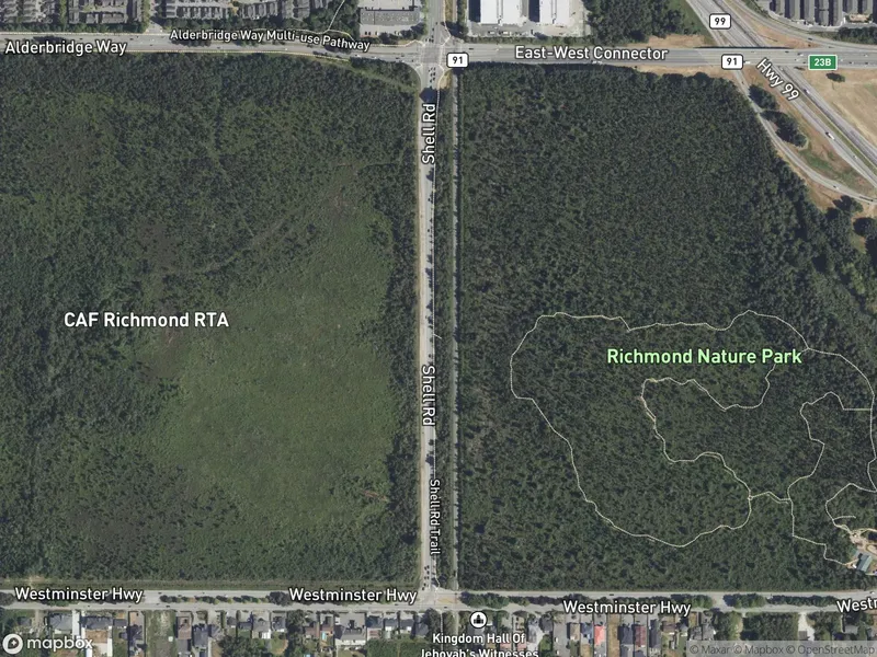
A 3.6 km tree-lined gravel trail through a rural-feeling corridor in Richmond's West Cambie neighbourhood. One of only seven designated off-leash dog areas in the city, with approximately 5 acres of off-leash space. Connects to the Horseshoe Slough and South Dyke trails for extended routes toward Steveston.
Best Suited For
The Crowd
- 🐕Dog Walkers
- 🔹Joggers
- 🔹Cyclists
- 🔹Solo Walkers
- 👨👩👧Families
- 🔹Commuter Cyclists
The Occasion
- 🔹Dog Walking
- 🔹Morning Jog
- 🔹Afternoon Walk
- 🔹Cycling Commute
- 🔹Quiet Walk
- 🏃Exercise
Route Details
A tree-lined gravel corridor running north-south through Richmond's east side. The trail has a rural, peaceful feeling with tall trees and shrubs creating a green canopy. Connects Alderbridge Way in the north to the South Dyke Trail in the south, passing through residential and agricultural areas. Includes an off-leash dog park area.
The Route
-
Alderbridge Way entrance km 0.0
north end
-
Off-leash dog park area km 1.5
-
Steveston Highway crossing km 2.0
-
Horseshoe Slough Trail junction km 3.0
-
South Dyke connection / Athabasca Drive km 3.6
south end
Along the Way
Tree-lined corridor with canopy — feels rural despite being in the city
Off-leash dog park area along the trail
Connects to Horseshoe Slough Trail for a loop option
Connects to South Dyke Trail for extended routes to Steveston
Quiet and peaceful — less crowded than the dyke trails
Accessibility & Facilities
Not Available
Not wheelchair accessible due to gravel surface. Stroller-friendly on dry days.