7.5km
Distance
250m
Gain
2.5h
Time
About this Trail
The Capilano Pacific Trail is a 7.5 km riverside trail from Ambleside Park to Cleveland Dam through old-growth forest, canyon viewpoints, and the free Capilano Salmon Hatchery. Features the dramatic Pipeline Bridge, dam views, and convenient one-way bus return options. Note: landslide detour in place near Keith Road.
Best Suited For
The Crowd
- 🥾Hikers
- 🔹Trail Runners
- 🐕Dog Walkers
- 👨👩👧Families
- 📷Photographers
- 🌲Nature Lovers
- 💑Couples
The Occasion
- 🔹Day Hike
- 🔹Photography Outing
- 🔹Educational Outing
- 🔹Weekend Adventure
- 🔹Date Hike
Highlights
-
A scenic 7.5 km one-way trail connecting West Vancouver's Ambleside Beach to the Cleveland Dam.
-
Offers dramatic viewpoints of the Capilano River canyon and the towering firs of the rainforest.
-
A section near Moyne Drive is currently closed due to a landslide, requiring a 3 km street detour.
-
Provides a rugged yet accessible urban hiking experience with moderate elevation changes throughout.
Route Details
A 7.5 km point-to-point trail following the Capilano River from Ambleside Park through old-growth forest to Cleveland Dam. The route passes through varied terrain including paved paths, gravel trails, forest floor, and long sections of stairs. Note: a landslide closure near Keith Road (since Jan 2021) requires a street-level detour.
The Route
-
Ambleside Park / Beach km 0.0
-
Railway bridge underpass km 0.3
-
Park Royal Mall backside — paved section km 0.8
-
Capilano River shoreline km 1.5
-
Keith Road — landslide detour begins km 2.5
-
Detour route via Moyne Dr / Stevens Dr km 2.5–3.5
-
Capilano Canyon viewpoints km 4.5
-
Pipeline Bridge km 5.0
-
Old-growth forest section km 5.5
-
Capilano Salmon Hatchery km 6.5
-
Cleveland Dam km 7.5
Along the Way
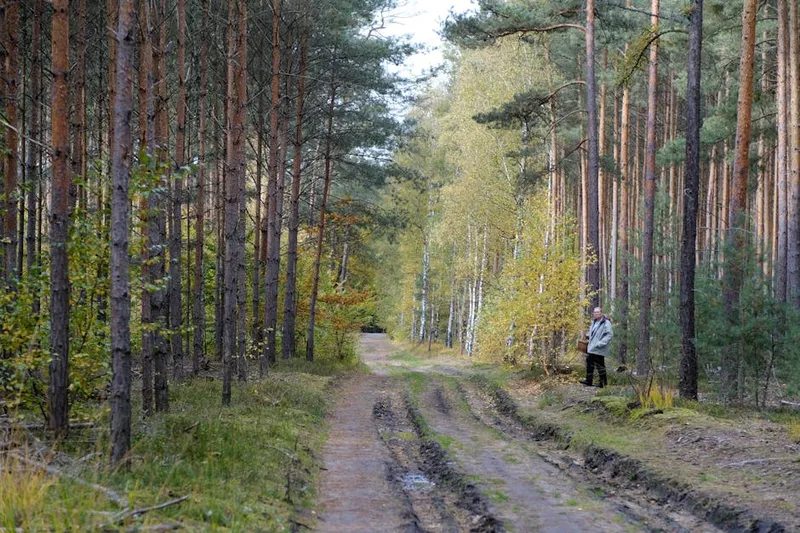
Old-growth Douglas-fir and western red cedar forest
Capilano Canyon viewpoints with dramatic cliff walls
Pipeline Bridge — blue/green bridge with large pipeline beneath
Capilano Salmon Hatchery (free admission, 238,000 visitors/year)
Cleveland Dam with views of Capilano Lake and spillway
Spring cherry blossoms along the lower trail sections
Dramatic dam spillway during snow-melt season
Rocky shoreline and beach areas near Ambleside
Practical Tips
Best Times to Visit
Insider Tips
- 💡
Start from Cleveland Dam for the best downhill direction
- 💡
Salmon viewing in fall at the Capilano Hatchery (free)
- 💡
Can be done as a point-to-point with transit connections at both ends
What to Bring
Accessibility & Facilities
Black ice on bridges and shaded sections in winter
Not Available
Not wheelchair accessible. Lower paved section near Ambleside is accessible but the forest trail has stairs, roots, and rough terrain.
History
The Capilano Pacific Trail follows the Capilano River through several parks. The river and its watershed have provided drinking water to Vancouver since 1889. Cleveland Dam was built in 1954 to create Capilano Lake reservoir.
Source · metrovancouver.org
Location
Getting Here
🚌 Transit
South (Ambleside): Bus #250 or #251 along Marine Drive. North (Cleveland Dam): Bus #236 from Lonsdale Quay, #232 from Phibbs Exchange, #247. One-way hike with bus return is a popular option.
🚗 Parking
Free parking at both ends. South: Ambleside Park large lot near beach and dog walk area (13th St & Marine Dr, West Vancouver). North: Cleveland Dam lot on Capilano Road north of Montroyal Blvd, North Vancouver.