13km
Distance
875m
Gain
7h
Time
About this Trail
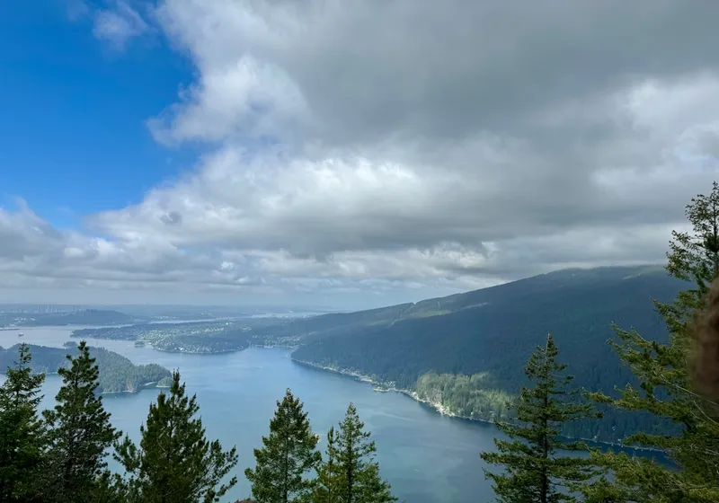
A challenging 13 km loop trail with 875m cumulative elevation gain along a forested ridge with 10 named viewpoints overlooking Indian Arm, Burrard Inlet, North Shore mountains, Sasamat Lake, and Vancouver Island. Buntzen Lake Recreation Area's signature hike. Free parking reservation required May-September. For experienced hikers only. 6-8 hours.
Best Suited For
The Crowd
- 🔹Experienced Hikers
- 🔹Trail Runners
- 📷Photographers
- 🧭Adventure Seekers
- 🔹Fitness Enthusiasts
- 🔹Peak Baggers
The Occasion
- 🔹Day Hike
- 🔹Challenge Hike
- 📷Photography
- 🌿Nature Immersion
Highlights
-
A legendary 15 km loop trail in Belcarra that traditionally offers ten distinct views of the coastal waters.
-
The trail is a strenuous climb that rewards hikers with dramatic overlooks of Indian Arm and Deep Cove.
-
Includes rugged terrain with steep switchbacks and dense second-growth forest sections.
-
Best paired with a refreshing post-hike dip in Buntzen Lake or Sasamat Lake nearby.
Route Details
The Diez Vistas trail (Spanish: 'ten views trail', also called Sendero Diez Vistas) climbs from the Buntzen Lake parking area to a ridge with 10 viewpoints. The trail passes through three jurisdictions: BC Hydro's Buntzen Lake Recreation Area, Metro Vancouver's Belcarra Regional Park, and Indian Arm Provincial Park. Return via the Buntzen Lake east side trail for the full 13 km loop.
The Route
-
South Beach parking lot km 0.0, elev ~130m
-
Diez Vistas trailhead junction km 0.5
-
Switchbacks — first viewpoint of Sasamat Lake km 2.0
-
East Point viewpoints (Punta Aprecio, Punta Del Este) km 3.5
-
Ridge high point — 560m km 5.0
-
Descent towards Buntzen Lake north end km 7.0
-
North Beach junction km 8.0
-
Buntzen Lake east side trail back to South Beach km 8–13
Along the Way
10 viewpoints along the ridge — Indian Arm, Burrard Inlet, North Shore, Vancouver Island, Sasamat Lake
Vista at Punta Aprecio (Appreciation Point) and Punta Del Este (East Point)
Three-jurisdiction trail: BC Hydro, Metro Vancouver, and Provincial Park
Old-growth forest sections with towering cedars
Connection to Buntzen Lake loop for complete circuit
Practical Tips
Best Times to Visit
Insider Tips
- 💡
Hike clockwise (ridge first, lake return) for the best sequence of revealed viewpoints
- 💡
The ridge is much longer and more demanding than it looks on the map — allow 6-8 hours for the full loop
- 💡
No water available on the ridge — pack at least 2L
- 💡
Check BC Hydro gate hours before going — gates lock at closing time and you WILL be locked in
- 💡
Cell coverage is very poor on the ridge — download maps offline
- 💡
The full loop returns via the Buntzen Lake east-side trail — a pleasant flat finish after the ridge
What to Bring
Accessibility & Facilities
Snow (Nov-June) — Gates open at 8:00 AM; closing times vary seasonally (as early as 4:30 PM in winter).
Not Available
Not accessible. Steep, rocky, root-covered terrain with significant elevation changes.
History
Sendero Diez Vistas — Spanish for 'ten views trail' — is the signature advanced hike of BC Hydro's Buntzen Lake Recreation Area. The trail was named for the ten distinct viewpoints along its forested ridge, offering panoramic vistas of Indian Arm, Burrard Inlet, the North Shore mountains, Sasamat Lake, and on clear days Vancouver Island. The recreation area has been managed by BC Hydro since 1971.
Source · buntzenlake.ca, bchydro.com
Location
Getting Here
🚌 Transit
Limited. Bus C26 to Anmore, then approximately 3 km walk to trailhead. Best accessed by car.
🚗 Parking
Free parking at South Beach lot. Online parking reservation required May 15 - September 1 (free, released daily at 7:00 AM for the following day via BC Hydro website). Morning, afternoon, or full-day passes available.