
5.5km
Distance
—
Gain
1.5h
Time
About this Trail
The Middle Arm Trail in Richmond, British Columbia, offers a scenic and accessible route along the Fraser River's Middle Arm. This paved pathway is ideal for a variety of outdoor activities, including walking, jogging, and cycling, providing continuous views of the river, the North Shore mountains, and local wildlife. It is a well-maintained urban trail that connects various points of interest along the waterfront. This flat and even trail makes it suitable for all ages and fitness levels. Starting near the Richmond Olympic Oval, the trail provides a tranquil escape within the city, allowing users to enjoy the waterfront atmosphere. Its consistent surface and lack of significant elevation changes contribute to a comfortable and enjoyable experience for casual strolls or more vigorous exercise.
Best Suited For
The Crowd
- 🔹Families With Strollers
- 🔹Casual Walkers
- 🔹Joggers
- 🔹Cyclists
- 🔹Dog Walkers
The Occasion
- 🔹Daily Exercise
- 🔹Relaxing Stroll
- 🔹Scenic Bike Ride
- 🔹Bird Watching
Highlights
-
Richmond Olympic Oval — a prominent landmark and starting point for the trail
-
Fraser River Middle Arm — offers expansive views of the river and its activity
-
Riverfront Pathway — continuous paved path along the water's edge
Route Details
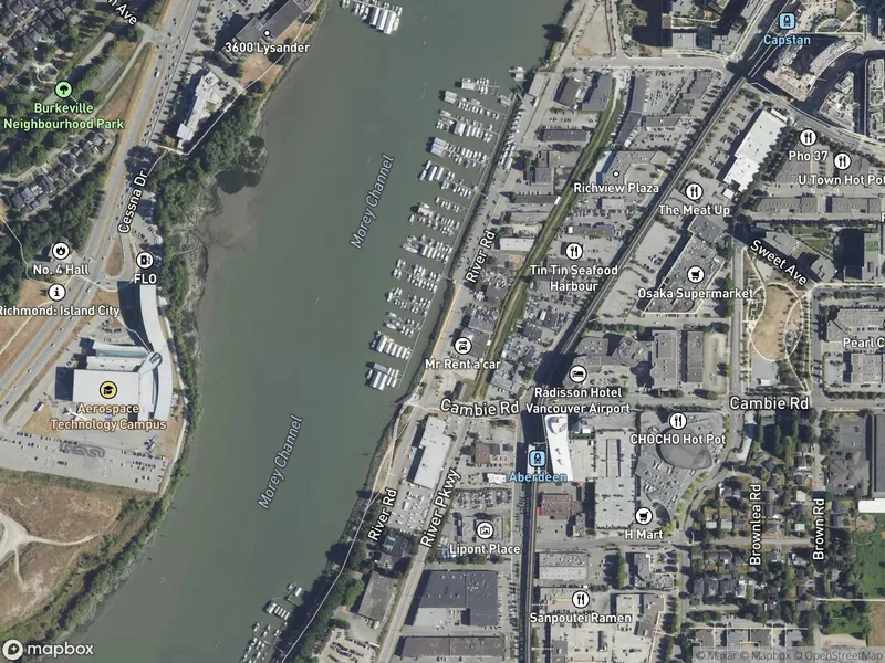
A flat, fully paved trail following the Middle Arm of the Fraser River. The route runs from Cambie Plaza west past the Richmond Olympic Oval, Dover Beach, and the UBC Boathouse to connect with the West Dyke Trail. Views of the river, YVR airport (planes taking off), and North Shore Mountains. Well-lit sections for evening walks.
The Route
-
Cambie Plaza km 0.0
eastern end
-
Richmond Olympic Oval km 1.0
washrooms, cafe
-
Dover Beach and skateboard park km 2.5
-
UBC Boathouse km 3.5
watch rowers
-
West Dyke Trail junction km 5.5
western end
Along the Way
Richmond Olympic Oval — 2010 Winter Olympics speed skating venue, now a recreation centre
UBC John M.S. Lecky Boathouse — watch rowing crews on the river
Dover Beach with skateboard park and viewing areas
Public art installations along the waterfront
Plane watching — YVR airport flight paths cross overhead
North Shore Mountains panoramic views
Connection to West Dyke Trail for extended routes
Practical Tips
Best Times to Visit
Insider Tips
- 💡
Connects to West Dyke Trail for a longer ride/walk
- 💡
Watch for planes — great for aviation enthusiasts
What to Bring
Accessibility & Facilities
Fully wheelchair accessible. Flat, fully paved trail at sea level with zero elevation gain.
History
The Middle Arm Trail is part of Richmond's extensive dyke trail network along the Fraser River, providing waterfront access through the city's agricultural and residential areas.
Source · richmond.ca
Location
Getting Here
🚌 Transit
Canada Line to Aberdeen or Lansdowne Station, then walk or bus to River Road. Multiple bus routes serve the area.
🚗 Parking
Free parking near Richmond Olympic Oval (6111 River Road). Additional free parking at Cambie Plaza and along River Road.