3.4km
Distance
165m
Gain
1.5h
Time
About this Trail
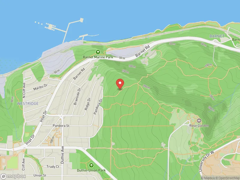
A steep 3.4 km forest trail on Burnaby Mountain with 165 m of elevation gain -- one of the most challenging routes in the conservation area. Climbs through dense rainforest to summit views of Burrard Inlet and the Kamui Mintara sculptures. Connects to Trans Canada Trail for a loop. Part of the 576-hectare Burnaby Mountain Conservation Area.
Best Suited For
The Crowd
- 🥾Hikers
- 🔹Trail Runners
- 🔹Fitness Enthusiasts
- 🐕Dog Walkers
- 🔹Experienced Walkers
The Occasion
- 🔹Hiking
- 🏃Exercise
- 🔹Nature Walk
- 📷Photography
Highlights
-
Burnaby Mountain's steepest trail — 165m gain in 1.7 km
-
Old-growth forest with towering cedars and ferns
-
Quiet trail rarely visited compared to other Burnaby Mountain routes
-
Connects to the summit trail network and SFU
Route Details
A steep, root-covered trail climbing through dense forest on Burnaby Mountain's north side. The trail has some of the steepest grades in the conservation area with uneven surfaces that require good footing. Climbs through mixed second-growth forest with occasional views of Central Harbour through the trees. Connects to the Trans Canada Trail at the upper end for a loop option back to the parking area.
The Route
-
Takeda Drive parking trailhead km 0.0
-
Initial forest section km 0.5
moderate grade begins
-
Steep section km 1.5
steepest grades, root-covered
-
Harbour viewpoint km 2.5
glimpses through trees
-
Trans Canada Trail junction km 3.4
loop option
Along the Way
One of the most challenging trails in Burnaby Mountain Conservation Area
Dense temperate rainforest with towering trees
Views of Central Harbour through the canopy
Connects to Trans Canada Trail for loop variations
Good workout trail — steep grades and uneven terrain
Wildlife habitat — deer, coyotes, eagles
Practical Tips
Best Times to Visit
Insider Tips
- 💡
Very steep — trekking poles help on the way down
- 💡
Can be slippery when wet — go carefully
What to Bring
Accessibility & Facilities
Very muddy and slippery in fall and winter.
Not Available
Not wheelchair accessible. Steep grades, uneven terrain, exposed roots, and dirt surface throughout.
History
Pandora Trail is one of several trails climbing Burnaby Mountain through the conservation area. It offers a more direct and challenging route compared to the main trails.
Source · burnaby.ca
Location
Getting Here
🚌 Transit
Bus #136 to Burnaby Mountain base area, then walk to Takeda Drive trailhead.
🚗 Parking
Free parking at Mountain Air Bike Skills lot off Takeda Drive. Shared with mountain bikers.