12km
Distance
300m
Gain
4h
Time
About this Trail
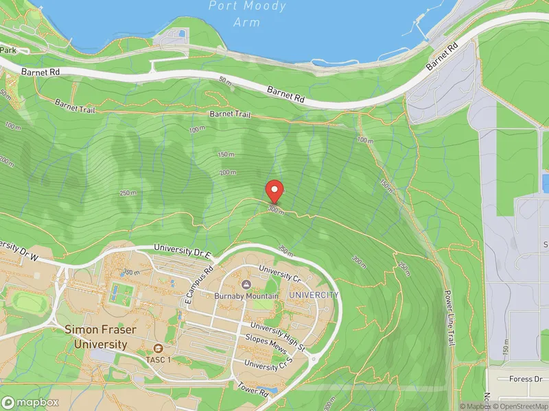
A challenging 12.1 km point-to-point trail crossing Burnaby from Barnet Marine Park to Boundary Road, featuring a steep climb up Burnaby Mountain with grades up to 28%. Panoramic views of Burrard Inlet and the North Shore Mountains reward the effort. Part of the Trans Canada Trail network.
Best Suited For
The Crowd
- 🔹Experienced Hikers
- 🔹Trail Runners
- 🔹Fitness Enthusiasts
- 📷Photographers
- 🔹Cyclists
- 🔹Urban Explorers
The Occasion
- 🔹Day Hike
- 🔹Photography Trip
Highlights
-
12 km trail traversing Burnaby Mountain through lush forest
-
Views of Burrard Inlet, Indian Arm, and the North Shore mountains
-
Connects SFU campus to the Burnaby Mountain Conservation Area
-
Totem poles and Kamui Mintara carved poles at the summit lookout
Route Details
The Trans Canada Trail through Burnaby is a 12 km multi-use route from Barnet Marine Park to the Vancouver-Burnaby boundary. The trail includes a challenging steep climb up Burnaby Mountain (with an easier alternate route via Barnet Highway) rewarded by fantastic views of Burrard Inlet. The route combines forested trails, paved paths, and gravel sections. Part of the national coast-to-coast Trans Canada Trail network.
The Route
-
Barnet Marine Park km 0.0
-
Burnaby Mountain base / power line corridor km 2.0
-
Burnaby Mountain summit — steep 28% grade climb km 4.5
-
SFU / Burnaby Mountain Park — Burrard Inlet viewpoint km 5.0
-
Scenic Park forested descent km 6.5
-
Confederation Park km 8.5
-
Penzance Drive paved section km 9.5
-
Montrose Park / Boundary Road terminus km 12.0
Along the Way
Burrard Inlet views from Burnaby Mountain summit
Connection to national Trans Canada Trail network
Mix of forest, urban, and parkland sections
Barnet Marine Park waterfront start
SFU campus and Burnaby Mountain Park at summit
Confederation Park and urban greenways on the west end
Practical Tips
Best Times to Visit
Insider Tips
- 💡
Start from the bottom for the uphill workout, or bus to SFU and hike down
- 💡
The Kamui Mintara lookout is the best viewpoint — don't miss it
- 💡
Can be combined with the Burnaby Mountain Conservation Area trails
What to Bring
Accessibility & Facilities
Ice and snow on summit sections in winter — Muddy sections possible in winter.
Not wheelchair accessible. The Burnaby Mountain climb involves steep grades up to 28% on unpaved trails. The flatter sections at either end may be partially accessible.
History
Part of the Trans Canada Trail network, this section traverses Burnaby Mountain, home to Simon Fraser University. The Kamui Mintara (playground of the gods) carved poles at the summit are a gift from Kushiro, Japan, Burnaby's sister city.
Source · burnaby.ca
Location
Getting Here
🚌 Transit
SkyTrain Production Way-University station and Lake City Way station (Millennium Line) within walking distance of mid-trail via SFU campus connectors. SFU campus accessible at the summit for food and washrooms.
🚗 Parking
Free parking at Barnet Marine Park (large lot, busy weekends May-September), Confederation Park, and Centennial Park. Street parking available at various mid-trail access points.